April 27, 2004
Mysterious markers
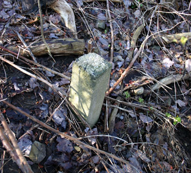
The other day I noticed concrete markers along the south side of Route 13. I'd driven by them for years without seeing them, but suddenly they seemed to be everywhere.
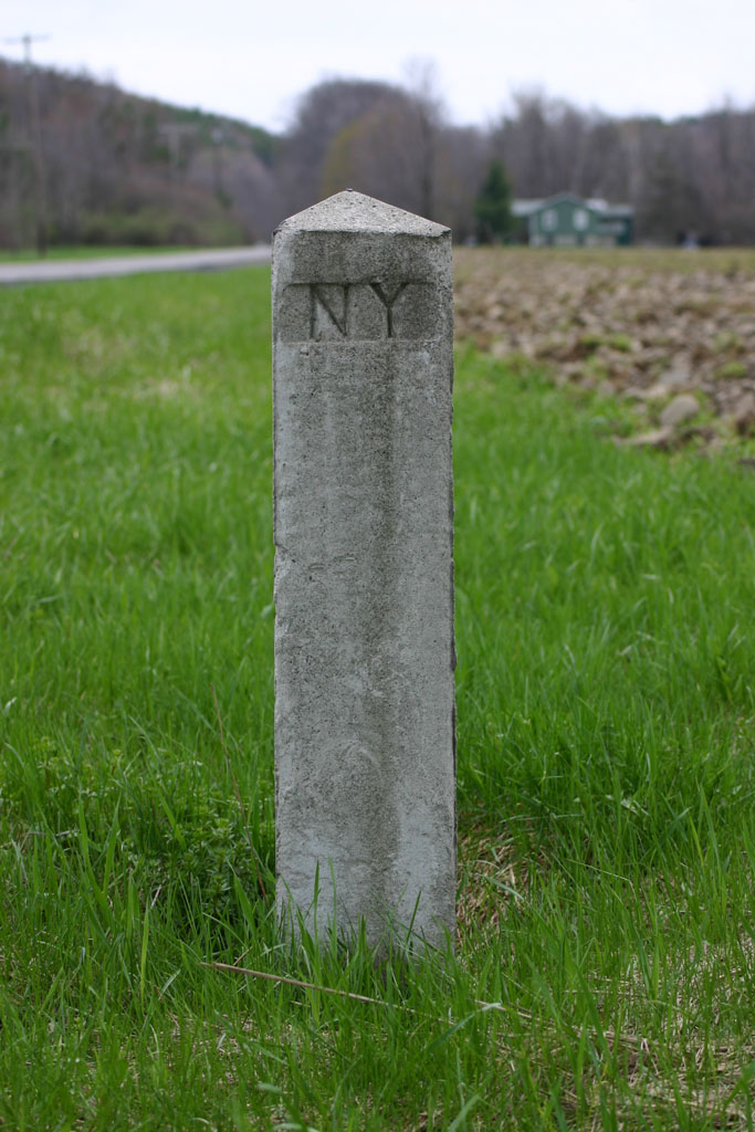
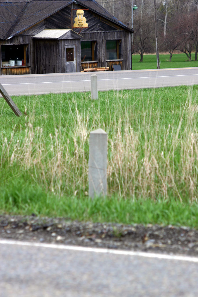
Monuments at Ringwood Road and Route 13
The survey map for my own house includes one of these, though the marker is in my neighbor's property by a few feet.
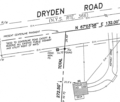
Survey map, 1259 Dryden Road.
Based on this map, my guess is that the monuments indicate the southern edge of the right-of-way for the highway. I'm still not positive of that, though, because there are places where groups of markers (like those at Ringwood Road) appear. These markers aren't just indicating the edge of the highway.
Another possibility is that the monuments indicate tax map boundaries, as my property is in the corner of a tax map section, but the highway seems more likely. If you have an explanation, please leave it in the comments!
Posted by simon at April 27, 2004 8:37 AM in maps , photos , roads, traffic, and transitNote on photos
These may be called Boundary Stones or Corner Stones. Surveyors once marked off property, township, and city boundaries in this way? I found your mention interesting, because I recall seeing these in our village community and had also wondered. I will have to take a look at Main Street today and see if the one I recall has been removed. I believe it had the Village name on it, though yours only had NY from what I can tell. Places where these may still be quite visible might include national or public preserves or parks?
A few links that may help shed a general light, though not answer your specific questions...
_One Such Marker - DC Boundary Stone, Southeast 4_
http://www.fairlington.org/Onesuch.htm
_Boundaries of the City - Past and Present_
http://www.btco.net/ghosts/oddsends/boundary/boundary.html
_Technology Breeds Birth of New Boundary Wars_
http://homes.wsj.com/buysell/regionalnews/20020814-forelle.html
It would be interesting to find a local historian or someone who could give a rough date for that stone, or investigate the history of the area? The closest dates I could find that were involved with boundary markers, late 1800's, 1880's - 1890's and the U.S. Geodetic Service. Before that they often used trees or existing stones as boundary landmarks?
I've always understood these to be route markers that were placed along state touring routes back in the 20s and 30s.There ARE quite a few still remaining along State roads in Tompkins County;stones that have survived accidents, road upgrades or route changes, that sort of thing. I suspect its like you said though...you don't notice them until one day....and then you "see" them everywhere.
If you are really curious about the history of this sort of thing, I would refer you to www.empirestateroads.com. If that guy doesn't have info on the stones on his site, maybe one of his links will help you out. Don't bother trying to email him though..I've been trying to get a reply from him for months with no luck. Guess its no longer an on-going project for him, although the site has a lot of good road info.
It was my understanding that these were municipal boundary markers as well - but the ones I mentioned on my blog (http://www.silent-edge.org/wp/?p=254) were in an odd location, well off the road, and also seemed to be marking out some sort of corridor or buffer between private property (a mall) and a large road embankment. (I've never seen these markers used to mark out a buffer; usually they are just roadside)
I am looking at the possiblity of buying a couple of old discarded stone protery markers for our new property. I think they are quaint. Any ideas where I could get some? Thanks, Billie
Just was wondering what they were also (Which is how I landed at this site) I see a couple here in Cazenovia, both of which are relatively close to Chenengo creek. One is just after bridge on Mill/Chenengo street and one is next to creek behind Buyea's parking lot. Last summer, I went biking down the Erie Canal near Fayetteville and saw a number of them