May 25, 2006
How much land does Cornell own?
One of the interesting features of the County's presentation on Natural Features Focus Areas was the maps for their Education and Research sections in various areas. I'd always known that Cornell owned lots of land in the areas around Varna and Ellis Hollow, but I'd never seen it mapped this explicitly:
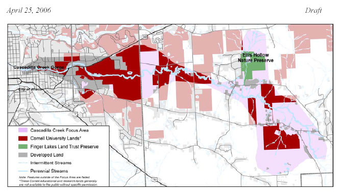
Cornell properties between Varna and Ellis Hollow, in red and pink.
Everything outside of the Cascadilla Creek Natural Features Focus Area (560KB PDF) is dimmed, so the Cornell-owned properties come in solid red (for land Cornell owns inside the focus area), lighter red (for land Cornell owns outside the focus area), and darker gray (for the main campus to the east of the focus area). Add to this the large chunk of land Cornell owns between Route 366 in Varna and Route 13, and that's a huge amount of territory.
(The map is wrong about one thing - much of this land is open to public use through Cornell Plantations. It'd be nice to see those properties marked separately from research or other land marked no trespassing. They also seem to be missing a few parcels, like the Cornell Statutory Fleet Garage.)
Posted by simon at May 25, 2006 7:44 AM in Cornell , Ellis Hollow , Mount Pleasant , VarnaNote on photos