August 31, 2009
Gas lease map
Talk about gas drilling is often pretty abstract. Signing a lease doesn't put a sign on the land saying "this land leased for gas drilling", and figuring out what has been leased can mean a long trip through stacks of deeds.
Today, though, you can take a look at what's been leased in Tompkins County, thanks to a new gas lease map from the Marcellus Accountability Project. The data was collected by hand, and there may have been changes over time. They do provide information if you want to go looking for more yourself.
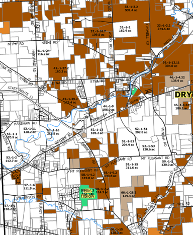
In my immediate neighborhood, just west of the Route 13/366 overlap, there isn't very much leased, except The Orchid Place and Autoworks. (White is unleased. Dark brown means surface rights are included in the lease.) Down the road in Varna, Hillside Acres is leased.

Gas leases along Routes 13 and 366.
I worry that that map may understate the leases around the Route 13/366 overlap, as Angelika was looking for possible orchard land in some parcels marked "unleased" there - but the owner made clear that he'd sold rights.
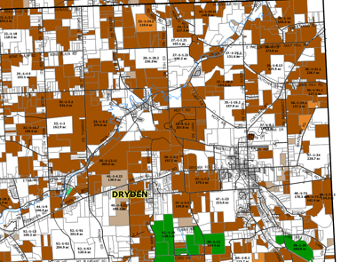
The area around the Villages of Dryden and Freeville is pretty heavily leased:

Gas leases around the Villages of Dryden and Freeville.
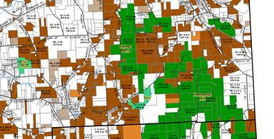
The southeastern hills are a mix of leased land and green state forest, making the state's decisions about its property seem extra-important.

Gas leases in the southeastern corner of the Town of Dryden.
Another sign making it a lot less abstract is a field services company "setting up a $30 million outpost" down the road in Horseheads.
Posted by simon at August 31, 2009 10:05 AM in energy , mapsNote on photos