June 20, 2010
Zip Code mysteries demonstrated
Not exactly explained, no, but at least you can see how strange local zip code boundaries are.
I grew up in Corning, which was 14830. Painted Post was 14870, Bath 14810, and Hammondsport 14840. That sort of made sense, until I noticed Addison was 14801, wondered why Elmira was 14901, and of course Ithaca was 14850.

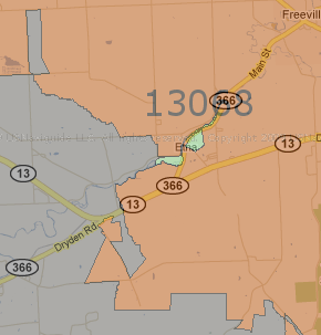
The strange boundaries between 14850 and 13068.
The map lets you see the various zip codes, including weird boundary issues like NYSEG's extending 14850 into the 13068 zone. I'd thought school district boundaries were strange, but these are even weirder.
Posted by simon at June 20, 2010 8:11 AM in mapsNote on photos