March 1, 2012
Trapped in the sausage-making redistricting machine
The Federal Courts have had enough of Albany's delay on Congressional lines, and ordered the legislature to hand over the maps. You can see the docket for the case (missing the Assembly maps?) and a complete set of maps submitted.
The key maps for Upstate and Tompkins County are:
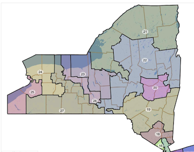
Assembly Democrats map (872KB PDF) - Tompkins + Cayuga + Onondaga + part of Madison
Assembly Republicans map (9.2MB PDF) - Outer Tompkins County towns in huge Southern Tier district to Jamestown, Ithaca/Danby to Binghamton/Utica district
Senate Republicans map (1.4MB PDF) - Tompkins + Cortland + Onondaga + northern Cayuga + Wayne
Intervenors (Rose) map (5.3MB PDF) - Tompkins + Seneca + northern Ontario + eastern Monroe
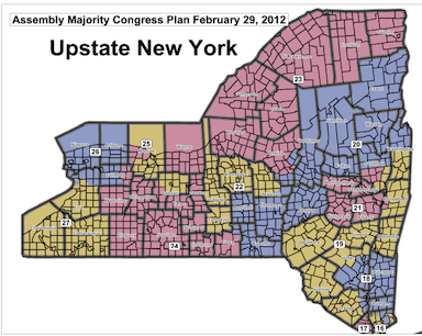
Assembly Democrats' map of Congressional districts
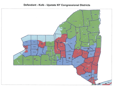
Assembly Republicans' map of Congressional districts
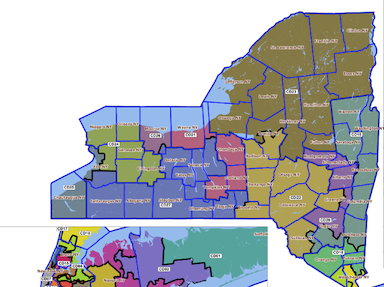
Senate Republicans' map of Congressional districts
All of these maps are bizarre, to put it mildly. The intervenors map (I don't know who they are, really), seems like a crazy effort to paint diagonal lines across Upstate New York with bonus strange gerrymandering in Broome County. The Assembly Democratic map creates a district that lurches from Binghamton and Cortland to Lake Champlain. The Senate Republicans map is at least mostly more compact, except for our district and the odd way they split up the Hudson Valley. The Assembly Republicans worst moment is here - they make sure that Tompkins stays weirdly divided.
(Senate Democrats didn't submit a map. At first I thought that was gutless of them, but as it turns out the contrast makes them look good.)
A special low point for me is the Senate Republican memo outlining "why incumbency protection is an appropriate factor for the Court to consider in drawing redistricting maps.".
So far, the only map I've seen that resembles sane is the Common Cause Reform Plan (8.3MB PDF), which actually creates compact districts of places that have something to do with each other beyond packing and cracking by partisan results...
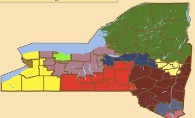
Common Cause map of Congressional districts
Common Cause has a larger explanation of what they're up to.
Update: I'd say this suggestion is even saner than the Common Cause map. The tricky bit for me is some splits around Rochester and Syracuse, but they aren't shocking splits. See? It's possible to create maps with coherent districts.
Posted by simon at March 1, 2012 7:06 AM in maps , politics (state)Note on photos
