February 22, 2004
Hamlet density
Yesterday's article explored the population of Varna and Etna, but even though it's interesting to know that downtown Varna's population is larger than Freeville's (679 to 505), the numbers needed to evaluate the statements about density in the Draft Comprehensive Plan have to relate those figures to area. Page 54 of the Draft Comprehensive Plan says:
"the residential development density proposed for the hamlet areas is an average of 8 dwellings per acre."
By my calculations, explained below, downtown Varna has an overall density of approximately 2.56 units/acre currently. At its densest southwest corner, using figures tilted to produce the highest possible density, it has a density of about 5.2 units/acre. Downtown Etna, which is harder to calculate, has a density of about 1.33 units/acre.
Getting these numbers is tricky. The choices that the U.S. Census Bureau made about census blocks map pretty badly to the yellow "hamlet" areas in Figure 5-1 of the Draft Comprehensive Plan (301 KB PDF). To calculate areas more precisely, we'll turn to a different source of data, the Tompkins County tax parcels map.
Like the census blocks map, the tax parcels map is available through CUGIR. The tax parcels map includes outlines of all the tax parcels in the county, as well as data about their areas, though not ownership or assessed value. (Again, you need to have software to work with these maps, and I'm using Manifold.)
Etna's density is difficult to calculate this way because the yellow in the Draft Comprehensive Plan map cuts across a 170-acre parcel in the north of Etna.
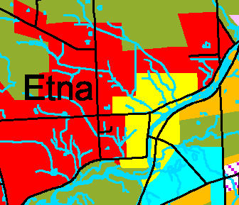
The hamlet area of Etna, as defined in yellow by the Draft Comprehensive Plan.
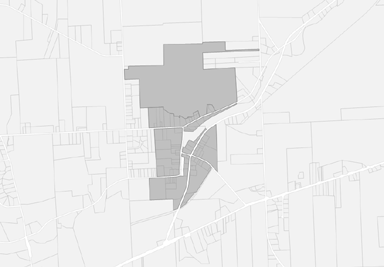
Tax parcels which include the hamlet of Etna as defined by the Draft Comprehensive Plan.
Leaving out that parcel at the top, Etna has an area of 136 or 129 acres, depending on which measurement in the tax parcel map you prefer. To come up with the largest density, we'll use the small acreage figure, so 172 housing units divided by 129 acres is 1.33 units/acre.
Varna is easier to calculate, as the yellow hamlet area in the Draft Comprehensive Plan maps more easily to tax parcels, as shown below.
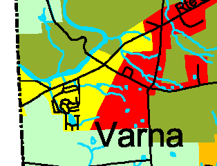
The hamlet area of Varna, as defined in yellow by the Draft Comprehensive Plan.
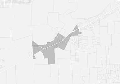
Tax parcels which include the hamlet of Varna as defined by the Draft Comprehensive Plan.
This is a smaller area than the census map, but it also includes far less uninhabited acreage, so should produce a higher density. In this case, the total acreage is 156 or 150, depending again on your preference in acreage calculation. Dividing the 385 housing units by 150 acres produces a density of 2.56 units/acre.
One corner of Varna, its southwest corner, is much denser than the rest of Varna because of the Hillside Acres mobile home park. I decided to see just how dense this area was to get an idea of the maximum density within Varna. The census blocks here combine very small pieces inside the park with a huge section including its edges and houses along 366.
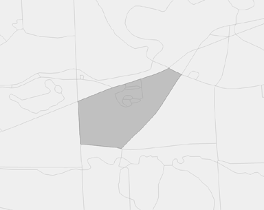
Census blocks which include the densest part of Varna.
There are 475 people and 277 housing units in that area. I then chose the occupied parcels within that set of census blocks:
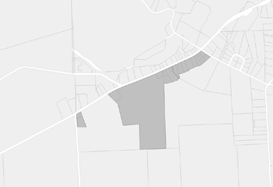
Tax parcels which include the densest parts of Varna.
The area for those parcels is 62 or 53.26 acres, depending on your preference. Taking the lower acreage again to produce the highest density gives us 277 housing units divided by 53.26 acres for about 5.2 units/acre. (It may be possible to come up with a slightly higher density by excluding undeveloped portions of Hillside Acres, but I don't have a surveyor handy.)
All of these densities are considerably lower than eight units per acre.
Update: I'd originally missed a 1.3-acre parcel (a small apartment block) on the left edge along Game Farm Road. That changes the acreage from 51.95 to 53.26, and the density from 5.3 to 5.2 units/acre. I've updated the numbers in the story to reflect this.
Posted by simonstl at February 22, 2004 10:50 AMNote on photos