September 26, 2004
Planning Board on subdivisions, trails, agriculture
The Dryden Planning Board met Thursday night, first approving a subdivision and changes to an existing subdivision, and then focusing on two of the more difficult parts of the Draft Comprehensive Plan, agriculture and trails.
The first item on the agenda was a public hearing about a proposed subdivision at approximately 200 Hunt Hill Road (map). Kent Moore wanted to subdivide a property to break off a 4.3-acre lot for sale. There was a fair amount of confusion surrounding maps on this one, partly because of an earlier submission of a more comprehensive plan and Moore's lack of detailed plans for the rest of what he wanted to do with the property.
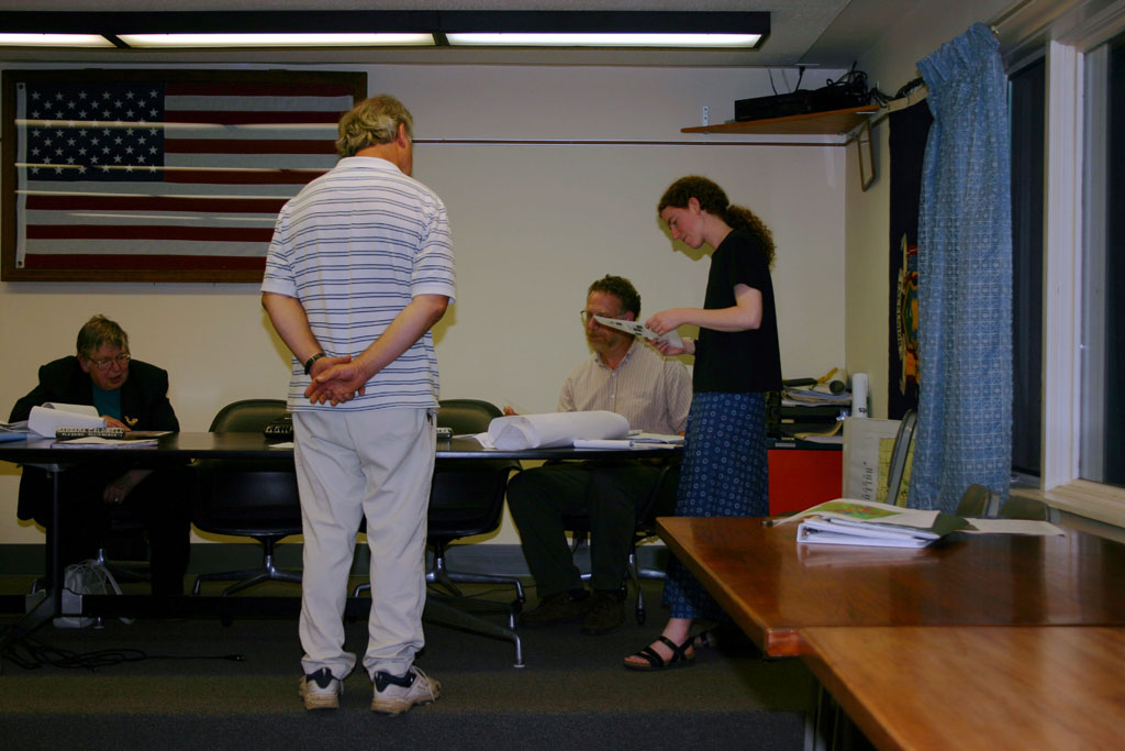
Discussing a Hunt Hill Road subdivision.
After a lot of discussion, Zoning Officer Henry Slater used a collection of colored markers to illustrate what was breaking off and what had happened before, creating a map that satisfied the board.
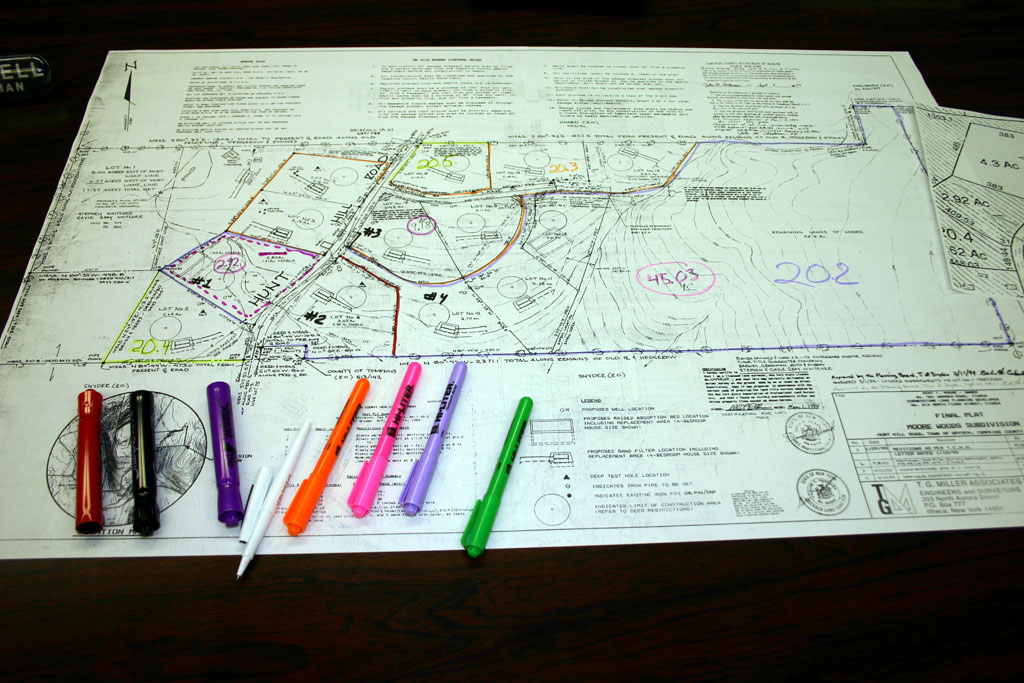
Colored map for a Hunt Hill Road subdivision.
The board gave initial approval to the subdivision - with conditions on planning approval for future subdivision - and passed a negative SEQR declaration for it. The next applicant was Brewster Chase, who wanted the board's approval on some revised boundary lines for an earlier sudivision. The board found the new lines to be both an improvement and not a substantial change to the overall form of the subdivision, and approved it.
The rest of the Planning Board meeting was spent discussing agriculture issues and trail issues, for the most part. They discussed the committee formed at the meeting earlier this month on agricultural issues, and expressed hope that the committee would give them concrete suggestions for the comprehensive plan. Planning Board member Tom Hatfield expressed concerns that some of the work might reflect general opposition to community involvement in land use decisions, but was hopeful that their input might help the board much the way that the earlier public information sessions had.
The board also discussed the prospect of Purchase of Development Rights applications in the town, as shown on the map below.
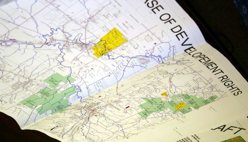
Proposed Purchases of Development Rights of farms in the Town of Dryden.
Planner George Frantz was happy to support such purchases and noted that buying 25% of the rights in an area can often be enough to keep development from sprawling, but also pointed out that "the biggest obstacle to PDRs in Tompkins County is land values. $600 an acre just isn't enough cash."
While he cited the number of survey respondents who were willing to spend tax dollars on rights purchases, Tom Hatfield also raised concerns about having a land trust hold the easements, feeling that the town needed to control its own destiny in such matters. (His comments sounded much like those of County Legislator Michael Lane at the August Town Board meeting.) George Frantz talked about how Massachussets provides a specific buy-back window for development rights after 25 years (at the new value for the land), but it didn't sound like New York had similar options.
Environmental Planner Debbie Gross also brought up a proposed New York State law that would have the state provide an income tax credit of up to $5000 covering 25% of local, county, and school property taxes on land covered by an easement. The board took no action, but sounded interested.
Trails were another important issue. Planning Board member Jim Crawford reported how much he had enjoyed "the pleasure of a well-maintained multi-use trail" while visiting Virginia Beach. There had been earlier discussion about removing the proposed trail through Ellis Hollow, and the board discussed once again how that might (or might not) work, noting the existing trails around the Ellis Hollow Community Center and suggestions from Town Board member Chris Michaels.
Tom Hatfield suggested that the Comprehensive Plan might do well to suggest more trails through the town than it does now, with the understanding that choosing and implementing those trails will be the job of the Town Board to do. More trails on the map are more possibilities, and also help make it clear that these are possible trails, not planned trails that will be implemented soon. While the railroad beds are an obvious opportunity for trail creation, Hatfield was especially interested in the possibility of using power line rights-of-way as another option for creating trails. George Frantz discussed the Town of Ithaca's experience working with NYSEG in creating the South Hill Recreation Way.
The board also discussed how trails might fit with the 2025 Long-Range Transportation Plan the county is working on.
Posted by simon at September 26, 2004 2:32 PM in Ellis Hollow , agriculture , planning and zoning , trailsNote on photos