December 26, 2004
Fire map
The 1996 fire coverage map for Dryden (the last one compiled, apparently still in use by 911) turned up a few months ago, and I've finally gotten around to scanning it. If you want to see a larger (32x32 inches at 200dpi resolution) version, click on this map.
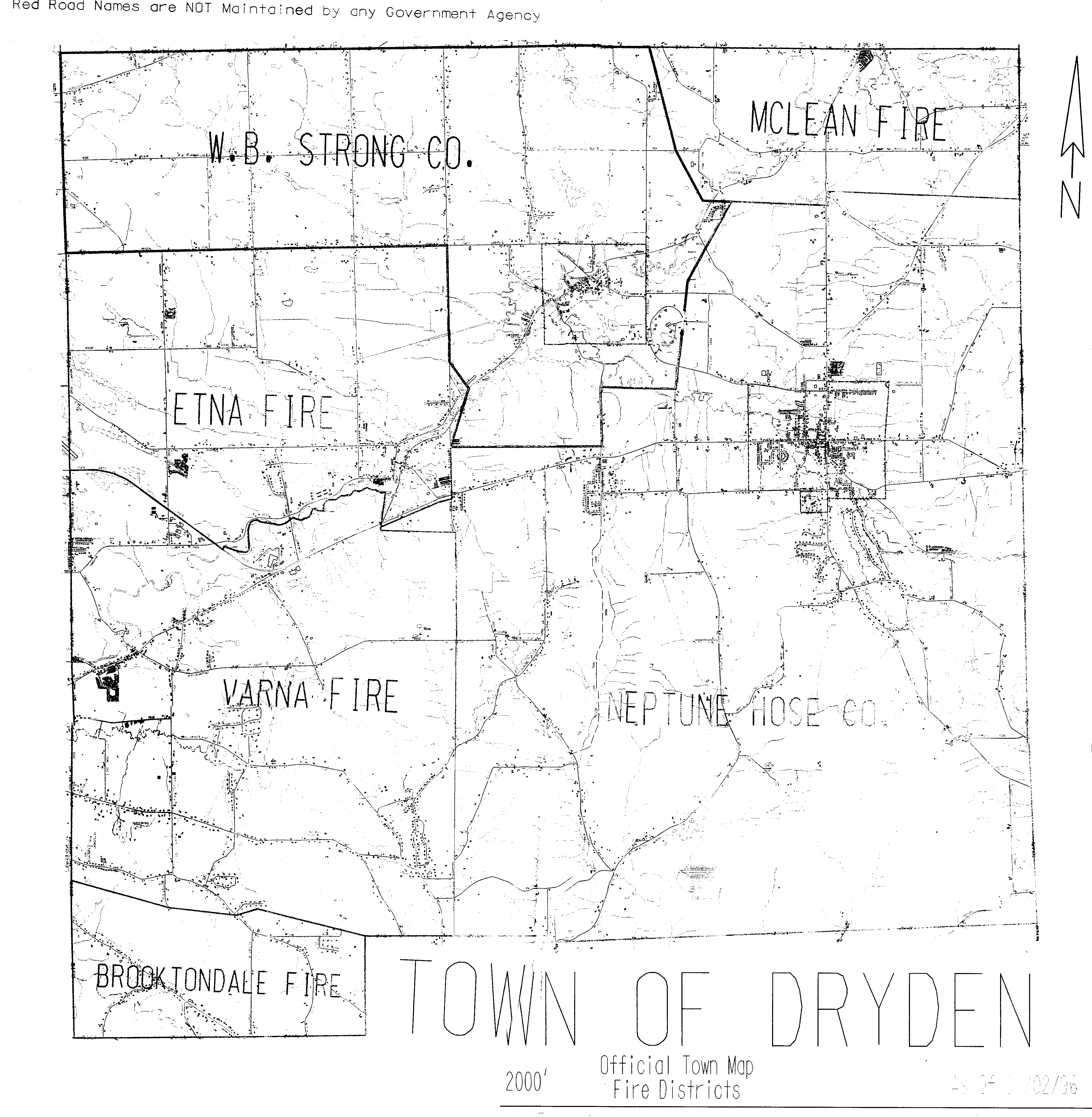
Fire coverage map for Dryden
I'll be making a prettier version based on recent map data, but this may be useful if you want to know which company covers your house. All of the companies could use more volunteers, so if you're at all interested, give them a call or drop by!
Posted by simon at December 26, 2004 9:39 AM in emergency services , mapsNote on photos