October 16, 2009
Gearing up for zoning
Almost a year ago, the Dryden Planning Board had a big overview meeting about upcoming zoning changes. It was fairly abstract, as they hadn't yet arrived at the details that make zoning conversations difficult. Last night, the Planning Board reconvened, in a joint meeting with the Town Board, and went over the proposed changes.

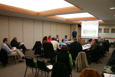
Town Board and Planning Board at joint meeting.
The revised zoning ordinance isn't cooked yet. They talked, for example, about removing an entire section that's more or less a repetition of state law on zoning appeals, and were going to have a subgroup meet to discuss the always difficult "who decides on special permits?" question separately. From what I gathered, the main changes from the old zoning are likely to be:
- Makes zoning correspond to the Comprehensive Plan and Design Guidelines
The Town hasn't revised zoning in a long time, but approved a Comprehensive Plan in 2005 and Design Guidelines in 2008.
- Meaningful zone names
Instead of "R-D", I'll be in "Rural Residential" with a possible "Neighborhood Development Overlay District" that allows for some higher-density development. Hamlets will be in "Hamlet" zones, and there will be Rural Agricultural, Conservation, Commercial, and Light Industrial/Office zones.
- Shift in frontage and lot size calculations
Instead of the simple but limiting calculations based on frontage and minimum lot sizes, the new zoning will allow for more flexibility based on how subdivisions are created. The math will definitely need some explanation, and they're including examples.
- More Planning Board involvement in subdivisions
Current law encourages landowners who want to avoid complex conversations to subdivide slowly and in ways that scatter houses. The new law would give owners and the Planning Board an earlier conversation on how to break up lots, while still letting landowners subdivide slowly to avoid a bigger property tax hit.
- Conservation areas get less development
The areas zoned "conservation" will have a formula based on original lot size that limits development to 1 house per 2.5 to 8 acres of total land.
- A more readable approach
Tables will reduce the amount of page-flipping needed to compare zones, and examples should ease the challenge of figuring out what it all means.
As Joe Lalley, Chairman of the Planning Board put it, they're working to create an approach that "is streamlined... but accountable".
It sounds like they'll be nailing down more details for a few months, but expect to see public meetings around the town in early 2010.
Posted by simon at October 16, 2009 12:34 PM in planning and zoningNote on photos