April 1, 2010
July 4th Fireworks coming to Dryden
I guess it's only for a year, while Ithaca College sorts out construction, but TC3 will be hosting July 4th fireworks this year. (There are lots more comments here.)
TC3 will also be having a summer course on local agriculture that I really wish I had time to take. Sadly, none of the participating farms is in Dryden, but they're certainly around us. (Berkshire, Marathon, Ithaca).
My zoning comments
Reviewing the draft zoning law and assembling comments took a lot longer than I'd planned (and yes, this is really only two pages in print). I'll expand on this further here in more postings, but I'd definitely be curious what other folks think of these. The draft documents - law and map - are available here.
Dear Town Board, Planning Board, and staff,
After following the Comprehensive Plan and a few other planning processes in Dryden, I'm happy to see a draft zoning law emerging from the process. I appreciate the hard work that went into it, and for the most part, I'm pleased with the balances the zoning attempts to strike.
I do, however, have a few concerns regarding odd prohibitions, and one broader concern about the Optional Traditional Neighborhood Development Overlay District (OTNDO) definition.
I think the Town is making a strange combination of mistakes with the current layout of Neighborhood Density Overlay Districts on the map and the definition of the OTNDO. When these overlays were first described earlier in the zoning process, I understood that they would be an optional tool the Town could use to allow denser development through an explicit approval process.
Looking closely at the draft and map, I was surprised to find that the overlays are scattered across the Town, but also that the density allowed is only six units per acre - the densest specified in the draft, but not that big a difference from the four units per acre already allowed in most zones where water and sewer are available. This doesn't quite add up. It seems odd, for example, to permit higher density to the east of Varna along 366 than is permitted in the hamlet itself, the supposedly critical node.
I would strongly recommend removing the NDODs from the current map. They seem mostly to create panic about the potential impact of zoning without actually accomplishing much. That might also make it possible to increase the density permitted in those districts (perhaps to 8?), to be applied as a planning tool that offers developers something of interest through an accountable political process managed by elected officials.
One large parcel that might reasonably receive that designation eventually is 56.-5-33, the 46.75 acre lot at the corner of Game Farm Road and Route 366, a parcel I consider the best place for dense development in the Town. The parcel is currently used by Cornell University for agriculture, and while I support that use, I see no good reason for the Town to limit it to agriculture for the future. It's a large and easily-developed parcel with access to water and sewer, as well as frontage on two roads, making it easier to distribute traffic. It's within easy walking distance of "downtown" Varna, and walking or biking distance from Cornell.
I'd strongly encourage the Town and Planning Boards to consider designating this parcel with hamlet zoning for the present. Agricultural use could continue there as long as Cornell wanted, but future development there could reinforce Varna while taking stress off roads in the rest of Dryden. (This was also marked agricultural in the Comprehensive Plan's Future Land Use map, a mistake I hope can be corrected in the zoning.)
The remainder of my current concerns are mostly focused on the Rural Residential zone the Town is applying to places that are more or less suburban.
The draft I have of the zoning ordinance prohibits Workshop/Garage in Rural Residential zones (p.22). Given the long history of woodworking as a specifically suburban hobby, I have a hard time seeing the point of prohibiting such shops, especially when they're limited to 350 square feet, in the RR zone. They're permitted in all other districts, not even requiring a special permit. I could, for example, build a shop in the conservation zone behind my house, but not on my current parcel. Of course, if I wanted to establish a "Business Group" Artist Studio/Craft Workshop, I could apply for a special permit, so this seems like an especially odd restriction on amateur pursuits. Please change the X to a P or at least to an SP.
The definition of Artist Studio/Craft Workshop is itself a little vague:
Artist Studio/ Craft Workshop - A place where artists, artisans, craftsman and other skilled tradespeople produce custom-made art or craft products, where they teach such skills, and/or where they sell such products. (p. 6)
The boundaries on that - what scale of commerce it applies to - are far from clear. Does it apply to people who join the Ithaca Art Trail? How much producing, teaching, or selling do I have to do before my work becomes a zoning problem? And if such work is in a residence, is it regulated under Home Occupation, where Level 1 explicitly prohibits signs? I think I understand the intent - AS/CW is meant for bigger operations - but fear that the draft is too vague on these matters.
I spent a while trying to figure out whether I could put up a sign in front of my house indicating that I had eggs or honey for sale. That seems to be an "Agriculture-Related Enterprise", and therefore banned from Rural Residential. I recognize that large-scale agriculture-related businesses might not be a good fit for Rural Residential, but find the side effects of this approach to be far too restrictive.
I wish the Town luck in its zoning revision process, and hope that these issues can be addressed easily.
April 8, 2010
Fence Installation, Part I
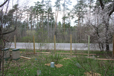
Folks passing by my house today might well wonder if I'm putting up a palisade. "First he writes about Upstate secession, and then he goes survivalist." Or maybe I've decided the answer to Route 366 traffic noise is a massive wall.
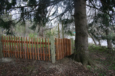
Nope. The posts provide the flexibility needed to put a 3-foot fence on my wobbling terrain. We're not fencing the whole property, but we do want to make it easier for Sungiva to know what the boundaries of the 'safe' parts of it are. We're also getting three gates put in to accomodate coming and going, and hope the fence will be attractive enough to enhance the house a bit. (The posts are pressure-treated, but the rest will be cedar.)
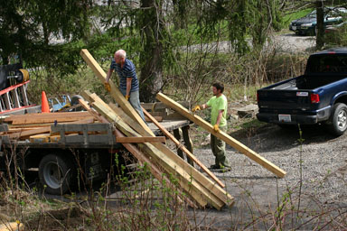
Whitmore Fence started early this morning, laying out the fence and digging post holes. By the end of the day, the posts were all installed, ready for the next steps of fencing and gates.
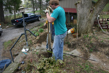
Bobby and Josh dig holes with traditional post-hole diggers.
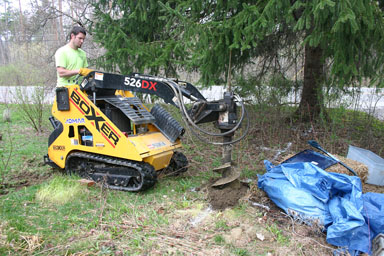
John creates post holes in a hurry.
I think everyone digging was happy that our soil isn't full of boulders. It went remarkably quickly, and the posts look ready for the next steps. For more of today's fun, you can see the gallery of photos I posted.
April 10, 2010
Fence Installation, Part II
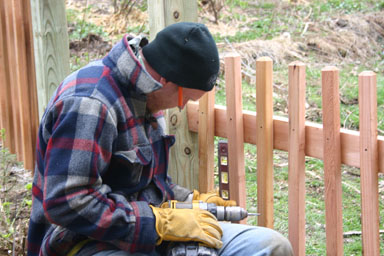
The new fence is starting to look less like the palisade or noise barrier I'd written about Thursday. John and Josh from Whitmore Fence spent yesterday installing all of the crossbeams and some of the spindles, and in some places you can now get a good sense of what the fence is going to look like when done.
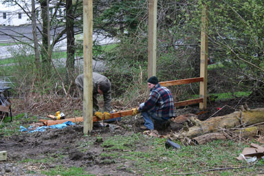
John and Josh installing crossbeams.
The original post installation had made me glad I'd hired people to do this because of the sheer amount of work digging those holes, and because they had that massive auger. Watching them yesterday, though, gave me a different sense - I couldn't have done this nearly as well on my own. Their approach gave them the flexibility to adapt the fence to the terrain while still keeping it looking right. I wouldn't have figured that out, and I'm still not sure I could do it having seen it. I'm especially glad we didn't go with fence panels - they might have worked at the front, but would have been a mess in most of the rest.
They'll be back Monday for the rest of the spindles and to install the gates, another tricky part to get right. If you want to see more, I've posted a gallery of the second day's work.
April 12, 2010
Fence Installation, Part III
Whitmore Fence thought it would take three to four days to install our fence, and I'm happy to report that it took a very reasonable three days of work.
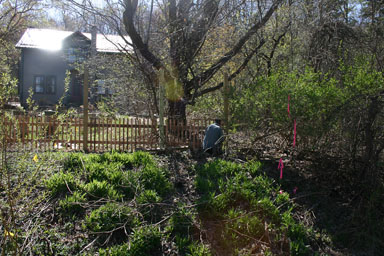
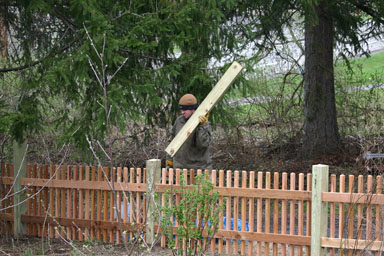
Josh installing westernmost spindles.
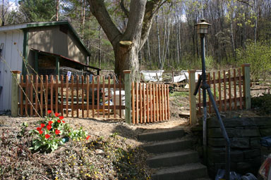
It included about 176 feet of cedar fence with pressure-treated posts, plus two regular gates (one on a slope) and a double gate, mostly separating the house (including the front and back yards) from the driveway and the road. It's not a complete fence, but it does make it much easier to know where the boundaries are.
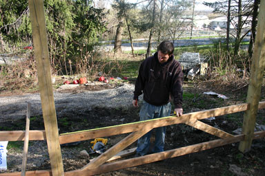
John building the double gate.
I was especially impressed with the gate-building. It went smoothly, and produced gates that open easily with a minimum of fiddling, even on the double gate. They offered us a choice of hardware, and we passed up a pretty design for something Sungiva would be slower to open.
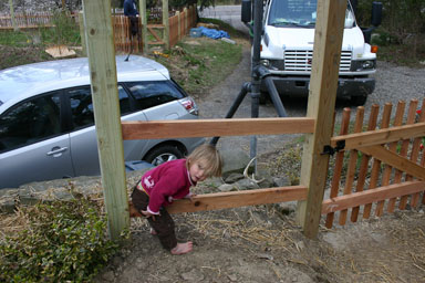
Why we wanted a fence with spindles.
The finished fence looks great to me, though putting a fence there makes a very big difference. In particular, it provides a different backdrop to the hillside right in front of the house, and makes me want to do something more attractive there. I spent some of the weekend chopping down sumac and honeysuckle, and now we need to figure what will go there instead.
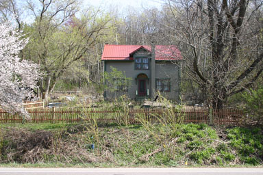
Completed fence from the road.
As always, I've posted a gallery of images if you want to see more.
April 16, 2010
Creek cleanups tomorrow
I'm delighted to see this happening, and hopefully some readers here will join the fun.
Cleanup of three Fall Creek watershed preserves, 9 am - noon, sponsored by DRAC (Dryden Resource Awareness Coalition), with the cooperation of the Fall Creek Watershed Committee.
Come help pick up trash in these beautiful preserves, along or near Fall Creek in the Town of Dryden!
Trash bags will be available. Snacks provided by Ludgate Farms.
- Genung Preserve - Rte 38 just north of Freeville - Martha Ferger will be there at 9 am as site coordinator.
- Campbell Preserve - Corner of Pinckney and Lower Creek roads just west of Etna - Hilary Lambert will be there at 9 am as site coordinator.
- Etna Preserve - Rte 366 as you enter Etna, across from the old graveyard - Margaret McCasland will be there at 9 am as site coordinator.
Dress for the weather, for early spring, and bring garden/yard gloves if you gottem.
Thanks to the Town of Dryden Highway Department for their support!
This is the kickoff cleanup for "Embrace the Lake," the Cayuga Lake Watershed Network's 2010 campaign to encourage folks to help protect the entire Cayuga Lake watershed by cleaning up the creek in their own backyard. Other creek cleanups are planned around the lake for May 8 and next fall, and we'll have more dates and locations soon. Check http://www.cayugalake.org for details, and how to organize your own creek or waterfront cleanup.
A cooperative venture with the Center for Environmental Sustainability and the Floating Classroom.
DRAC is online at www.draconline.wordpress.com.
April 20, 2010
Southworth Library talk Wednesday night
Tomorrow night, the Dryden Town Historical Society will be looking at a key piece of the Southworth Library's past and how it will transform the future of the library. Library Trustees Mary Ellen Rumsey and Mike Lane will discuss the handwritten Lincoln manuscript the library auctioned last year to raise funds for a major addition - what it is, how it came to Dryden, and how it became a substantial financial contribution to the library.
The free presentation will start at 7:00pm at Dryden Village Hall.
One vision for Varna: The 2005 Comprehensive Plan
One of the strangest things anyone has said to me in the conversations about the proposed Varna II development is "Haven't you read the comprehensive plan? It's all there." I was too startled to really respond about just how wrong a statement that was. The Comprehensive Plan doesn't call for development that resembles Varna II.
It's time, though, to take a closer look at what that plan - the basis for current zoning proposals, as well as the Town's Design Guidelines - really says. It reflects about a decade of work by the Planning Board, slowly building consensus before approval by the Town Board (then composed completely of Republicans) in 2005.
If you'd like to read the whole thing, you can find the Comprehensive Plan on the Dryden Environmental Planner's web page. I've excerpted the hamlet section (pages 52-58, minus figures and sidebars) below. All boldfacing is mine, as are remarks in [ ] brackets. I think, though, that this actually lays out a clear vision of how Varna (and Etna, McLean, and the area north of the Village of Dryden) should develop.
Hamlet Areas
The hamlets of Etna, Varna, McLean (Dryden portion), and Dryden (north of the Village of Dryden) require an approach to land use and development that differs substantially from the rest of the town.
The goals of development in hamlets should be:
- Encourage new development that would increase the attractiveness of the area by offering a diversity of development options, including townhouses, duplexes, small multiunit complexes, and mixed residential-commercial.
- Encourage home ownership.
- Regulate hamlet transformations so that the character of the community is maintained or shifts slowly, not in dramatic steps. [continued...]
Typically hamlets are more densely developed, with residential land uses mixed with or in close proximity to small scale commercial development. Lots tend to be smaller and population denser than in the rest of the town. However, it is important to maintain a healthy balance between home owners and renters. This balance encourages long-term residents who are invested in the community. Hamlets are attractive areas to live in because they can offer many of the amenities of village living.
To create a more attractive environment for new commercial and residential development within its hamlets the town of Dryden needs to create new land use regulations. These regulations should offer a mixture of opportunities, some that allow more dense development, on smaller lots and without the large yard setback areas typically found in suburban areas, and some that maintain the current average of onehalf acre lot sizes. Another feature of hamlet development is the use of two story structures that house commercial, office and residential use under one roof. With more compact development, amenities such as sidewalks are also possible.
The residential development density proposed for the hamlet areas is a maximum of 4 dwellings per acre. As with the Suburban Residential areas of the future, the Hamlet areas would be comprised of several types of residential zoning districts with varying maximum allowed densities. Multiple residence zoning districts could be appropriate within the Hamlet areas. Mixed-use zoning that would allow, for example, apartment-style residences above ground floor commercial space would also be an appropriate land use tool. To maintain the balance between home ownership and rental housing and to prevent rapid change in the hamlet character, multiunit developments should be limited to a maximum of 20 units.
Higher density single-family owner-occupied residential development, such as a collection of town houses, can be encouraged through the creation of small zoning districts, comprised of 1 to 3 acres each, that allow detached and attached dwellings on a few small lots scattered through the hamlet. These districts should be widely spaced through the hamlet at a minimum distance between them to minimize their visual impact on hamlet character.
Multi-family developments with a maximum density of 8 units per acre could be constructed in new multiple residence zoning districts. The size of these districts should be limited to preclude the construction of large-scale apartment complexes that could adversely impact the character of the community. Instead the Town should limit the size of such districts to between 2 and 2.5 acres in area so that a maximum of no more than 20 units could be built in any one complex.
Village- or hamlet-residential zoning districts have been developed elsewhere in Upstate New York to accommodate such development. These zoning districts encourage more compact development by reducing lot size requirements as well as setback requirements. Side yard requirements are reduced to 5-10 feet or less and lot coverage limits raised. These special districts should be established in a manner that keeps them from dominating a hamlet, but maintains a mixture of development opportunities.
Crafting land use regulations and guidelines that would allow the hamlets in the town to evolve into attractive, vibrant communities will require considerable care. Clear guidelines for mixed use development that might combine residential with retail commercial uses are necessary to ensure that future development results in quality affordable housing, adequate parking, and a design and character that is compatible with the existing community character. They must continue to encourage home ownership.
For most parcels in the hamlet the density should be maintained at its current level. To control the development process, the town should require that a developer seeking a higher density on a given parcel request a zoning change, placing the responsibility on the developer to prove why their proposal fits with the plan's vision for hamlet growth. This procedure for the approval of new development is much more likely to give the town the power to create the type of heterogeneous set of densities sought for the hamlets. These special districts within the hamlet could be designated for higher density opportunities with the following standards:
- Setback and design standards for the street-facing facades of buildings. Maximum front yard setbacks are a tool commonly used in many communities, primarily to encourage return to the historic pattern of downtown commercial buildings being built at the edge of the public right-of-way;
- No side yard setback requirements for attached structures, and minimal setback requirements for detached structures;
- Limiting parking in front of buildings to that provided for on the street. Off-street parking must be located to the side or the rear of the property;
- Increased lot coverage limits to 80 percent or more;
- Strict definition of the types of retail or service establishments that would be allowed within the mixed-use area. Automobile-oriented businesses such as gas stations, convenience stores and fast food restaurants should be excluded as permitted uses.
- Additional side- and rear yard buffers where a mixed-use zoning district would abut a residential district.
In communities where municipal water and sewer services are available lot sizes in the range of 11,000 square feet are used to encourage compact residential development in areas surrounding the core of a hamlet or village.
Specific standards for such development are critical, and should include:
- Limiting uses to single- and two-family homes;
- Street design standards that ensure on-street parking lanes, curbs and underground stormwater drains, and sidewalks;
- Standards for landscape plantings within the public right-of-way, including spacing, types and sizes of trees and shrubs;
- Provisions for garages, including prohibitions of free-standing garages in front yard areas, standards for alleys that could provide access to garages in the rear yard areas of lots, and for additional setbacks and shared driveways where alleys are not practical;
- Maximum overall site densities, building height limit of 2 stories, bulk limits and maximum site coverage limits;
- Development done in a manner that architecturally fits with the current styles of the town;
- A mixture of appropriate commercial and residential uses in the hamlets controlled through initiating maximum set-backs and preventing drive-through businesses.
Municipal water and sewerage services give greater flexibility in designing a hamlet environment. These are available in Varna, but not in Etna. Etna however is close enough to the existing water and sewer lines that serve the area around the NYS Rte. 13/NYS Rte. 366 intersection, that extension of service is possible. As with all areas designated in this plan to be logical locations for future implementation of water and sewer line, this plan does not advocate construction of new lines in advance of development. Such extension of service should be considered after a density has built up in the area to warrant supporting it. Once such service has been added, it can provide the catalyst for redevelopment of that hamlet and provide the infrastructure to support the envisioned Suburban Residential area to the hamlet's west.
In addition to the recommended changes in land use policies within the hamlet areas, there needs to be an investment in the physical infrastructure of the hamlet areas, particularly in Varna.
NYS Rte. 366 in Varna, with its wide travel lanes and road shoulders and attendant 40-MPH speed limit, is designed solely to function as a highway that allows traffic to move quickly and effortlessly through the hamlet. The width of the highway and attendant 40 MPH speed limit, while successful in moving traffic, have had a significant adverse impact on the quality of life of Varna residents, and the character of the community.
The roadway should be reconfigured wherein its original primary function of quick and efficient movement of traffic is subordinated to it functioning as a village "Main Street." Toward this goal the Town should work with the New York State Department of Transportation to redesign and secure funding to rebuild the roadway to:
- Eliminate the existing highway shoulders and replace them with curbing, tree lawns and sidewalks within the highway right of way;
- Provide for on-street parallel parking opportunities on at least one side of the on-street;
- Create a safe intersection at Freese Road and Mt. Pleasant Road;
- Reduce the speed limit through the hamlet to 30 MPH. [on its way in 2010]
Reconfiguration of NYS Rte. 366 from a road designed as a highway to one designed as a main street would significantly enhance the livability of Varna. This in turn would make the hamlet more attractive to investment in new family-oriented residential and neighborhood scale commercial development. Figure 5-3 [page 63 in the original] illustrates how the highway-to- main-street and proposed hamlet zoning concepts could be applied in the vicinity of the Freese Road/Mt. Pleasant Road intersection.**
It is important to the maintenance of the hamlet of Etna that the area south of the hamlet and north of Rt. 366 is kept as a green-space corridor of low-density conservation land use, with some rural residential land use surrounding the intersection where Rt. 366 leaves Rt. 13 to move north. A green-space corridor of low-density conservation land should be maintained to the west of this area along Rt. 13 as an important visual break for travelers on Rt. 13, separating the built-up areas surrounding Ithaca from the rural residential community of Dryden.
So far as I can tell, both the design guidelines and the zoning drafts are still following more or less along these lines. I did suggest returning to the denser-zones-by-request model in my comments about the zoning, but that is, I think, the only substantial variation from this proposal, and a way to implement the 20-unit ceiling suggested here.
April 21, 2010
Trapped away from Freeville
Rachel Dickinson, who was once the Ithaca Journal's Dryden Town Talk columnist, writes of pining for Freeville while being stuck in Ireland because of the Icelandic volcanic ash cloud.
In this week's Dryden Town Talk, Cathy Wakeman explores events that Dickinson may not be able to get to: a capella performance, a talk about Southworth Library, a Habitat for Humanity conversation at the Dryden Community Center Cafe, the Grange's annual community service awards, a craft fair, and a barbecue.
The proposed Dryden school budget includes a 6.48% tax levy increase while cutting spending 1.88%, thanks to cuts in state aid. Ithaca schools have a 3.97% levy increase and a 2.4% increase in spending.
Dryden's newest preserve
David Weinstein writes to let folks know of a wonderful new spot he visited during the weekend creek clean-up:
I had the good fortune to help pick up trash at the Campbell preserve on Lower Creek Road this past Saturday. It is a wonderful small preserve, with extensive wetlands in the interior and a tranquil and serene stretch of Fall Creek all along it's southern border the entire length of the property, an inviting place for a spring or summer picnic.
We are incredibly lucky to have people like the Campbells who were willing to donate a property like this, and a town board that was willing to accept it as a park to remain natural and undeveloped. There wasn't a whole lot of trash, just 2 or 3 garbage bags full, which means it has not yet been heavily visited.
Someone (Jack Bush and company, perhaps?) is maintaining a trail that winds through the property's fields. I highly recommend taking a short walk through this park, which celebrates Dryden in all it's finest!
I believe this is the southeast corner of the Pinckney-Lower Creek Road intersection.
April 22, 2010
Cortland County Dems on Arcuri, healthcare
It's a little to our east, but the Washington Post has a piece on Cortland County responses to the 'no' healthcare vote that Congressman Michael Arcuri cast last month.
Varna speeds and Mt. Varna height both decline
I was marveling today about running across the following pieces in a 1999 Varna Community Association revitalization proposal:
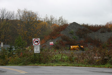
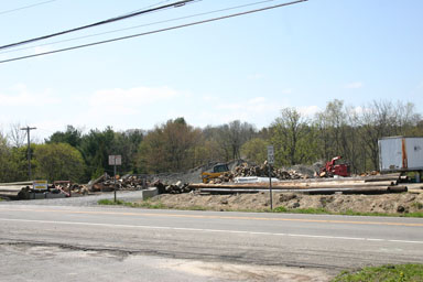
Another area at the corner of Freese Rd and Rt 366 has been used for dumping fill and wood chips. The owner of this property has been in frequent violation of Town nuisance ordinances and has been ordered closed on more than one occasion. Nevertheless, the Town has granted the owner a special permit to use the property in said fashion assuming he makes an effort to conceal the site with vegetation and restrict access for safety reasons. Still this facility is immediately adjacent to residential properties which necessarily are robbed of peace and quiet when the site is in operation....
Two years ago about 100 signatures were secured by petition to ask that the Town petition the State to have speed limits reduced by 5 to 10 mph throughout the hamlet. The greatest felt need was to reduce the 40 mph zone to 30 mph from just east of the commercial center by Mt. Pleasant Rd to the Lucente apartments near the western boundary. While the town did act on the hamlet's request, the State has failed to take any action...
Objectives
- Continue to promote speed limit and traffic calming measures with the State DOT. Reducing the speed limit to 30 mph in the designated commercial revitalization zones and densest part of the community would greatly enhance safety for pedestrians and traffic trying to enter the driving lanes from residential and commercial driveways.
- Restripe the roadway to include a no passing zone through the designated commercial revitalization zones.
A decade later, these issues are finally resolving:
- The passing zone disappeared last fall,
- speed limit signs were posted this week lowering the speed to 30mph through downtown Varna, and
- the height of the fill dump, which was never particularly concealed and has sometimes been called Mount Varna, is finally declining.
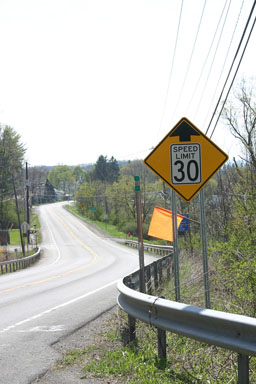
Newly posted 30mph signs in Varna.
Ten years is a long time, but a lot of the same people who wrote that document saw it through despite the difficulties. Perseverance can pay off.
(And for those more concerned with their wallets, I should report that the State Police have enjoyed their new Varna hunting grounds for the last few days.)
April 25, 2010
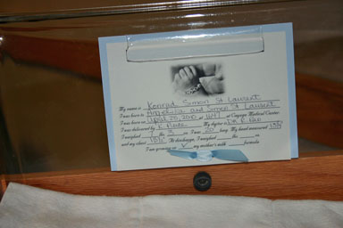
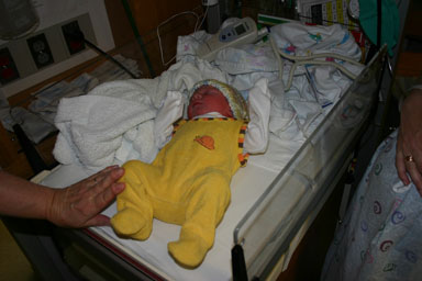
Konrad Simon St.Laurent arrives
He was a little early, but Angelika realized this morning at church that little Konrad wanted to see the world soon. Thankfully, he was quick, and we now have a delightful son to raise.
April 26, 2010
Sungiva meets Konrad
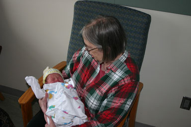
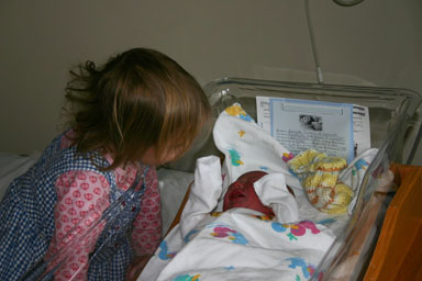
My mother, Sungiva, and I set off for Cayuga Medical Center this morning to see Angelika and Konrad. Sungiva and my mother had to meet our new arrival!

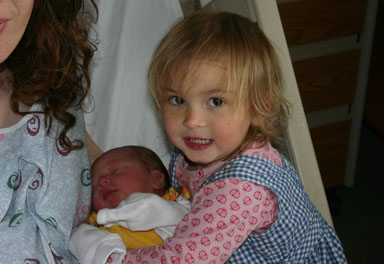
Sungiva gives her little brother Konrad a kiss.

Angelika hugs Sungiva and Konrad.
If all goes well, Angelika and Konrad will be home tomorrow, and I'm sure there will be more exciting adventures.
Another vision for Varna: The Varna Community and Commercial Revitalization Plan
Back in 1999 and 2000, the Varna Community Association was looking ahead to how their hamlet should look, setting concrete goals that described their hopes. As I mentioned earlier, some parts of that plan have only just recently come to pass, while other parts have developed over the years.
This vision is obviously far more specific to Varna than the hamlet sections of the Comprehensive Plan I posted earlier. It's also more of a brainstorm and less of a polished document, having had far less time to percolate, fewer people arguing over it, and no paid consultant to formalize it. In many ways, however, I think that's a virtue, as it offers a snapshot of people's ideas.
I've posted the complete original plan, as well as a condensed version (45KB PDF) David Weinstein assembled. The original starts with lots of history and includes more information, while the condensed version focuses on goals and objectives.
(I've put my own updates this, indicating things that were completed, in curly brackets ({}).)
Varna Community and Commercial Revitalization Plan
Purpose: The purpose of this plan is to address issues in the community which have had and continue to have a deteriorating effect on the community, both with regard to quality of life and livability concerns as well as maintaining and encouraging commercial activity which will help revitalize the community.
History of Varna
The hamlet had its beginnings in 1859 when farmers purchased properties to the east of Game Farm Rd, built houses and settled together to form the community known as Varna. Up until nearly the middle of the last century, Varna had all the components of a viable community. The hamlet contained two churches, a post office, school, tavern, hotel, dance hall, grocery and a carriage shop which later converted to a garage and gas station.
The railroad also went through Varna, connecting the hamlet to larger communities and markets and accommodating mass transit for travelers, hauling supplies, farm animals and other merchandise. The rail depot was purchased by a private individual after the railroad stopped running and converted it into a small house. Other changes included the hotel which was located at the current Mt. Pleasant Rd intersection with Rt 366. After the hotel closed it was moved back from the road where it stands today and then converted into apartments. The former post office was located just across the street from the current Methodist Church.
Varna at one time had a small industry. Fall Creek flows through Varna and many mills were located on Fall Creek. In Varna there were two mills--a sawmill located at 944 Dryden Rd near where the hexagonal red barn is located today and a grist mill located just down the road from the saw mill.
The first school was located on the corner of Freese Road and Rt 366 and was later moved across the street and operated as a "one room school" until the late 1940s when Varna School consolidated with the Ithaca City School District. In the late 1920s and early 1930s electricity and street lights came to Varna. Later in the 1960s sewer and water were made available.
The "tavern property" was located in the center of the hamlet at 922 Dryden Rd. Drovers from the surrounding areas frequented the tavern, having brought their livestock to Varna, and then stayed overnight before continuing over the Catskill Turnpike to Owego where animals were loaded onto rail cars bound for New York City.
In its early years Varna consisted mostly of farm families and children. In 1949 the community recognized the need for a community center to hold public meetings, and provide spaces for other public and private events. Property was acquired and the center was built using all local people and resources. Later a playground was added for the children. The Center then became the hub of activity in Varna. Scout troops for both boys and girls were organized along with 4H, Home Bureau, a summer playschool, and a senior citizens group. Several of these activities continue at the Center and others such as the youth programs are being reactivated after a hiatus.
After a barn fire, the community decided it needed a fire company located in Varna. The Varna Fire Company was organized in the early 1950s and housed in the Community Center until 1968 when the Varna Community Association sold an adjoining parcel of land to the Fire Company to allow for expansion and to build an addition onto the original Community Center Building. In 1998 the Fire Company moved to a new facility on Turkey Hill Road and sold their building adjoining the Community Center to Bell's AutoCare.
In the words of one long-time resident, " Varna is [and has been] a genuinely nice place to live".
I. Description for the Hamlet of Varna
Varna is a hamlet located mostly along State Route 366 between Game Farm Road to the west and the intersection of Rt 366 with Rt 13 to the east. We would also include residents in the area on the north along Freese Rd to Hanshaw Rd and Forest Home Drive to the Town Line; and on the south along Baker Hill Rd and Deer Haven Rd across Mt. Pleasant to the intersection of Turkey Hill Rd and Stevens Rd continuing along Stevens Rd to Game Farm Rd.
Land use as defined by Tompkins County Assessment property codes includes a substantial land area that is owned by Cornell University and is classified as either undeveloped (which includes the protected Cornell Plantation lands) or agriculture. Most of the remaining area is classified as residential. The majority of commercial development is located near the intersection of Mt. Pleasant Rd and Rt 366 and further to the west along Rt 366 (see map) {Sorry, I don't have the map}. This area holds the most promise for commercial revitalization which conforms to a small scale mixed uses and which are compatible with a moderately dense residential neighborhood.
Housing and Demographics
According to the 1990 census figures the Hamlet area as defined above has a population of 983. Within these demographics there are 198 family households listed. The total housing stock equals 477 units of which 196 are rental units and 136 are single family residences. Median house value ranges from 32,500 to 225,000 with most units valued under $100,000 (1990 valuation). Most of the population and housing density exists between Turkey Hill and Monkey Run Roads on the east and Game Farm Road on the west. {For more recent demographics, see my hamlet census and hamlet density pieces.}
Commercial Activity
Businesses in the hamlet include the following: Treeforms, Saunder's Greenhouse, The Antlers Restaurant, Service Master Cleaners, Staley Associates, Embassy Inn, Pleasant Valley Electrical Contractor, Fantasy Auto Repair, Bell's AutoCare, Varna Auto and the Varna Inn, Savage Creek Hair Salon and Hillside Acres (home trailer sales/rentals). In addition, Kimball Realestate and Lucente Homes manage the bulk of apartment rental units in the hamlet. In summary, there is one furniture store, two motels, three auto repair businesses, one gas station, one hair salon with the remaining being professional or service oriented businesses. In addition, to storefront businesses there are two lawn care businesses that operate in the hamlet and a few small home-based consulting offices.
Community and Public Spaces
Community and public places include the Varna Community Center, the Varna Fire Company, State Game Farm and Cornell Plantations lands including Park Park located at the corner of Rt 366 and Forest Home Drive. Cornell University lands also include an undeveloped mostly landlocked forested area to the south of the Varna Community Center and experimental fields to the north of Fall Creek. Fall Creek runs through the hamlet with most of the development directly to the south of the creek. Hiking trails are located in the Park Park and in the Cornell Plantation lands bordering the south side of the creek. An undeveloped, proposed hiking trail runs along an old railroad right a way cutting through the center of the hamlet.
The Varna Community Association runs and maintains the Community Center located at 943 Dryden Rd. During the past three years, the Association has raised over $60,000 in funds to renovate the building, build a community playground and a trail linking the Center to the Hillside Acres Trailer Park. The Community Center is the focus for community events and programs to support community programs including Alcoholics Anonymous, Varna Chapter of the Tompkins County Senior Citizens, summer youth programs and an after school science club. The Center is also available for public meetings and low-cost private rentals.
II. Community and Commercial Revitalization Issues
A number of revitalization issues have been identified which impact the hamlet in different ways. The broad categories include: the proportion of home ownership to rental units; the lack of businesses or commercial establishments which might cater to pedestrian traffic within the hamlet such as a diner or coffee shop; and the need to enhance: community connections, public safety, beautification, transportation and public awareness of community affairs.
Goal: Work with the Town to reexamine zoning in the hamlet so as to focus and limit certain types of development, identify a commercial center and enhance the prospects for more owner occupied single family residences redressing the current imbalance of rental to permanent residences.
Current zoning in the hamlet is RC, one of the least restrictive as to where commercial and multiple housing units can occur. The current definition even allows for agricultural uses. Aside from the agricultural experimental fields on Cornell lands across the creek and adjacent to Mt. Pleasant Road; the only other agricultural use is the Game Farm which is used to raise game birds for release. Commercial agriculture no longer exists in the hamlet area.
A Revitalized Commercial Center
The area from just east of the Mt. Pleasant Road/Rt 366 intersection west to the Hillside Acres Trailer Park represents the densest development and population in Varna. It also includes most of the existing commercial establishments except for a few scattered along Rt 366 toward the eastern boundary of the hamlet. In addition, there are some lots and spaces where new commercial activities might locate within this area.
Business Opportunities for Pedestrian Traffic
Aside from the hair salon close to the Hillside Acres Trailer park and a laundry facility in the small commercial development adjacent to the junction of Mt. Pleasant Rd and Rt 366 there are no commercial establishments such as a food mart, coffee shop or diner which might be located close to residential center and serve pedestrian traffic. While there may be some question as to the viability of such an enterprise, it is possible that such a facility if appropriately planned and scaled may be financial successful and may also create a locus for community networking on a more daily basis. The commercial area located at the intersection of Mt. Pleasant and Rt 366 is currently underdeveloped. Likewise, there also exist vacant lots/and spaces to the west of this intersection along Rt 366. These locations are within easy walking distance of a substantial residential population.
The other area of the hamlet where there has been commercial activity is on the eastern edge of the hamlet near the junction of Rts 366 and 13. Two large commercial lots remain empty located near the existing TreeForms Furniture store. Located at these sites previously were the State Police barracks and the Box Car restaurant. These lots have sewer and water and significant paved areas for parking and represent in addition an excellent location for a Park and Ride facility to reduce commuter traffic through Varna (see below). {The State Police barracks is now AAA, while the Box Car is now The Orchid Place.}
Home Ownership vs. the Number of Rental Units
As indicated from the 1990 census data, the demographics indicate that over a third of the housing units are rental exceeding the number of single family housing units. Many of these rental units are occupied by Cornell University students or families or individuals renting trailer units. A majority of the housing stock is less than $100,000 in 1990 value. As a measure of income distribution, the hamlet demographics include a majority of low to moderate income populations including a substantial number of elderly.
With the large number of rental units in the hamlet, especially student housing, a substantial component of the population tends to be mobile. This combined with the relatively low proportion of single family home ownership creates a measure of transience in the community. The average income level and housing values is also skewed by the number of residents housed in the three trailer parks within the hamlet. Hillside Acres is by far the largest with about 50 percent of the trailers privately owned. The other two smaller parks are located off Forest Home Drive and Freese Rd. Raising the proportion of single family home ownership might be one way of increasing community cohesion and creating support for certain kinds of commercial development and/or expansion within the hamlet.
Objective:
Work with the Town to revise the zoning for the hamlet area in order to identify areas where commercial development and mixed use is compatible with existing residential neighborhoods. Define the types of commercial activity compatible with a mixed use zone. Designate ares where high density multiple unit housing can be located and areas which are reserved for single family housing development.
Goal: Continue to renovate and make improvements to the Varna Community Center, improve landscaping of its grounds and generally enhance the space for use by the public.
Currently, the Varna Community Center is the only public place available for community support programs, events and public meetings in the hamlet. In the past three years the Center and the Varna Community Association, Inc. which owns the facility have both undergone substantial positive change. The Association raised over $60,000 to renovate, expand the facility and bring it up to current building code. The original building was built with donated materials and labor and no longer met current standards. Most of the several thousand hours of labor associated with the latest renovation was also donated.
The Center provides space for a range of activities associated with assisting community cohesion. Summer youth camps have been held the past two summers. Dryden youth have participated in helping construct the community playground, After school programs have been supported by local residents the past three years including a home work club and a science club. The center provides free space for the Varna Senior Association and Alcoholics Anonymnous and hosts a local card club. In addition, the Center serves as a voting center, and meeting for public meetings. In the past the town board and planning board has held several public forums at the Center regarding potential impacts to the community. Finally, the Center serves the community as a place which can be rented inexpensively and used for private parties and events such as wedding and anniversary parties. Completing remaining renovations and improvements on the Center building and grounds and assuring long-term fiscal stability for operations and maintenance of the facility are critical to maintaining this space as a community center.
Associated with the Center grounds is a community playground which was completed this past summer. This is the only playground within a several mile area, and is a focus for outdoor youth activities. This past summer the playground was upgraded with the assistance of the Ithaca Youth Bureau and Dryden youth who also constructed a bridge and connecting trail to the Hillside Acres Trailer Park permitting a safe passage for children from the trailer park to use the playground without having to traverse the shoulder of Rt 366.
Objective:
- Complete renovations of the outside of the building to improve its overall appearance and relandscape areas in the front and rear of the facility. {done}
- In addition, repair the existing signbase identifying the Varna Community Association and provide signage on the building to identify it as the Varna Community Center; thereby distinguishing it as a separate structure from the adjoining Bell AutoCare facility which occupies the old fire station and shares a common wall with the Center. {done}
Goal: Support trail and sidewalk construction for pedestrian traffic and improve safety for pedestrian and cyclist traffic along Rt 366.
Aside from the recently constructed trail connecting the Center playground with the Hillside Acres Trailer Park there are few pedestrian walkways in the hamlet. The old railroad right of way is one which provides a hiking trail through the center of the hamlet, but access is only from Mt. Pleasant Rd and the trail is largely undeveloped with the need for upgrading especially to make it a public right of way. The Town of Dryden has expressed interest in developing it as a public right of way for pedestrian traffic. In this same vein there are no connecting pedestrian walkways along frontages connecting houses in the hamlet. Given that the set speed limit is 40 mph and traffic largely moves in excess of the speed limit and given that the only pedestrian walkway is on the shoulder of the highway, this poses some considerable risk and impediment to pedestrians who wish to walk to visit neighbors or just take a leisurely stroll. Without safe pedestrian ways there is a barrier for neighbors to visit and to get to know newcomers in the hamlet and for children to travel safely to the community playground.
Objective:
- Support efforts of the Town to secure funding to develop the portion of the Dryden Trail System which will connect with the Ithaca Town Trail continuing along the old railroad right of way to Rt 13.
- Explore funding possibilities from DOT, the county MPO and other sources for a sidewalk and curbing in the right of way abutting Rt 366 along the denser portions of the hamlet in the area from Mt. Pleasant Road to the Lucente Apartments near the western edge of the hamlet. This is the same area which would include the Commercial Revitalization Zone.
Goal: Work to enhance community pride, beautification and involvement in community affairs.
Community Connections
Civic pride and responsibility is based on voter participation in local affairs. This is a responsibility of being a good citizen. The Community Center is a designated polling place for regular elections. The Center Board petitioned the School District to reestablish voting on school elections at Varna as well. In the past year the School Board has reinstated Varna as a polling place; thereby making it easier to senior citizens to vote. A corollary to this is that it makes it possible for registering new voters and encouraging voting participation by holding information forums on candidates for local elections. In the past year the Center in cooperation with the League of Women Voters held a forum for candidates for the Town election.
At one time Varna had a hospitality committee which greeted newcomers to the hamlet. While this may seem to be an old fashioned concept in todays telecommunications world, it nevertheless may be just as valid in terms of being appreciated and welcomed to the community. There are hurdles to implementing such a program, given that Varna has a large transient student population and lacks the backyard communications of typical small communities. Through the years many of the long-time older residents have passed on or lost touch with newer residents. In addition, home ownership may turn over more frequently, than in years past. Nevertheless, the Varna Community Association feels that this may be an activity worth exploring as a means to rebuild connectivity in the community.
Much of what happens in one area of the Town frequently impacts other parts of the Town. Similarly, neighborhoods may have similar issues. Therefore, it helps to share activities with other neighboring community associations. The Varna Community Association along with three other community associations joined this past summer in hosting a Summerfest--an event for families. This activity may form the basis for further joint activities in the future. The purpose of this event was to bring attention not only to the community centers, but also to historical features in the rural parts for the County.
Beautification
In general the community has maintained its appearance; however there are parts of the area especially along Rt 366 which could stand improvements and enhancements. This includes the facade for the Varna Community Center which has already undergone extensive renovations and expansion. Many of the oldest structures in the hamlet are located along Rt 366 and many of these have been converted to rental properties in recent years--- some of which are owned by local residents, but others are managed by absentee landlords or a reality company. Some of these structures are in need of minor fix ups and painting and/or could use simple landscaping to improve the looks of frontages.
At least one defunct commercial establishment, a former repair garage, is in serious need of repair and has junked vehicles parked on the lot detracting substantively from the appearance of neighboring properties. Another area at the corner of Freese Rd and Rt 366 has been used for dumping fill and wood chips. The owner of this property has been in frequent violation of Town nuisance ordinances and has been ordered closed on more than one occasion. {Finally seems to be shutting down.} Nevertheless, the Town has granted the owner a special permit to use the property in said fashion assuming he makes an effort to conceal the site with vegetation and restrict access for safety reasons. Still this facility is immediately adjacent to residential properties which necessarily are robbed of peace and quiet when the site is in operation. Current zoning in the hamlet is RC, one of the least restrictive as to where such operations can occur.
Most property owners in the hamlet are very conscious of maintaining lawns, planting flowers and in general trying to provide a pleasant appearance to their properties and to passers by. Building on this desire to have well-maintained and attractive properties in the hamlet may be a means to build on community pride and further enhance Varna as an attractive place to live.
Public Awareness
For a community to act it needs to be in communication. Because many residents are either isolated or have not built any attachment to the community due to the fact that they are transient or have just recently moved into the area, awareness of local issues and how decisions are made may not be part of their daily business. At present there is no community newsletter which circulates to all households. In the past two years, the Varna Community Association (VCA) has had a limited distribution newsletter; however the Association has been limited by not having a bulk mailing permit from using the postal service along with inadequate funds to make the newsletter a regular mail delivery. Recently, the VCA secured its 501 (c)3 tax exemption status with the IRS along with recognition as a charitable organization by the State of New York. These designations make it possible to secure a bulk mailing permit at reduced postal rates.
As land use decisions are made in and around the hamlet area, various impacts are felt by current residents. While growth will continue, the question of how it will continue and in what shape it will take form are obvious concerns for long-time residents and new property owners in the hamlet. It is a measure of community awareness, given the level of participation at public meetings and communications to town boards, as to whether community and commercial revitalization can succeed. To the extent that such awareness can be generated means that public spaces for discussion need to be available along with a regular newsletters and possibly electronic means of communication.
Objective:
- Provide opportunity during election years to candidate forums such as those sponsored by the League of Women Voters to better inform the public about local issues and the position of candidates running for local elective office. In addition, make available voter registration materials for those new members of the community eligible to vote.
- Enhance the Center programs to better serve youth, seniors and families in the community. Maintaining some kind of an after school program for youth has been a priority for the past three years. This has been especially important given that school buses arrive before parents arrive home from work. The school district has been cooperative in the past in dropping off children at the Center who are interested in these programs.
- Maintain and improve the Center's community playground area and equipment. Considerable effort and expense has been expended in the past three years with the help of the Dryden Youth Commission and Ithaca Youth Bureau to construct the playground. Some maintenance will be required on a continuing basis to maintain it. In addition, as funds become available some additions maybe added.
- Plan and implement a beautification program in the hamlet. This may include promoting better landscaping fronting Rt 366; asking the Town to enforce the junk ordinance to remove junk vehicles and assist the community in applying for Main Street funding to help improve appearance of residential and commercial buildings in the community through paint and fix up days. An item which has been discussed is the planting of a large number of daffodil bulbs along Rt 366 to herald the arrival of spring and promote a Spring Daffodil Festival.
- Expanding community connections through a regular newsletter is an effort just now underway in order to help expand community participation in the Varna Community Association and interest in maintaining the Center and its programs as a hub for a renewed and revitalized community.
- Continue to work with neighboring community associations on issues in common and to promote the Summerfest program which was launched during the summer of 2000.
Goal: Support measures to improve public safety
Public Safety
Public safety is a significant concern in any community. Chief concerns in the hamlet include pedestrian safety, speeding vehicles and fire prevention. While the community has been generally viewed as safe from crime and vandalism, discussions have been held at the Center advising residents regarding personal and home safety measures.
Traffic
Rt 366 has become a major thoroughfare, at times reaching maximum or near maximum capacity. Rt 366 is a significant shortcut for traffic heading to Cornell parking and offices as well as truck delivery for Cornell, East Hill Plaza and other points in the City of Ithaca. Traffic appears to have increased steadily in recent years. At the same time traffic speeds have also increased. Currently posted speed limits of 40 mph through the hamlet seem excessive given that the only pedestrian walkways connecting households in the densest part of the hamlet are the shoulders of the road. These shoulders are used by several senior citizens, children of various ages and adults living in the community. With traffic, including large heavy trucks moving frequently at speeds in excess the posted speed limit, pedestrian safety is of increasing concern.
Along with traffic reduction is the need to reduce traffic speed. Two years ago about 100 signatures were secured by petition to ask that the Town petition the State to have speed limits reduced by 5 to 10 mph throughout the hamlet. The greatest felt need was to reduce the 40 mph zone to 30 mph from just east of the commercial center by Mt. Pleasant Rd to the Lucente apartments near the western boundary. While the town did act on the hamlet's request, the State has failed to take any action. {30mph signs just went up.}
Likewise, residents leaving or returning by car for or from work, running errands, etc. are often confronted with long lines of cars before being able to pull out of their driveways. While line of sight is fairly good for most areas in the hamlet, the combination of speed and long lines of traffic sometimes cause people to take a chance in accessing the driving lane. This is also evident by the several accidents at the intersection of Freese and Mt. Pleasant Rds with Rt 366. where cars have been hit in one direction or the other while either crossing 366 or turning onto the driving lane.
Another noted concern regarding traffic has been the observation, that drivers observing the speed limit are often passed--mostly legally, but sometimes illegally on the right (i.e. by passing on the shoulder). With the density of driveway entrances and use of the shoulder by pedestrians and cyclists, such behavior increases the risk of serious injury or fatalities. Unfortunately, recent repaving of 366 through Varna did not include the use of a double line, no passing zone, through the densest part of the hamlet.
Fire Protection
Varna is fortunate to have a well-equiped and dedicated fire company located in the hamlet on Turkey Hill Rd near the junction with Rt 366. In addition, it has a rescue squad trained to deal with non fire emergencies. Nevertheless, fires do occur from time to time occasionally damaging or destroying structures. The fire company and rescue squad relies on volunteers to donate time to operate the equipment and be available for answering calls when needed. This takes a dedicated citizenry willing to provide time to be trained and be on call. Recruitment of volunteers has been of some concern in recent years as the community has experienced more residential turnover.
Citizens watching out for each other is the sign of a healthy community. It is also an effective measure to minimize potential criminal activity or vandalism. Over the years as long-time residents have moved away or passed on, newer residents may not be as well known to the community and these neighbor to neighbor linkages are broken. Reestablishing neighbors looking out for neighbors might be part of a neighborhood watch program. Currently there is no structure for such a program or organization.
Objective:
- Continue to promote speed limit and traffic calming measures with the State DOT. Reducing the speed limit to 30 mph in the designated commercial revitalization zones and densest part of the community would greatly enhance safety for pedestrians and traffic trying to enter the driving lanes from residential and commercial driveways. {done}
- Restripe the roadway to include a no passing zone through the designated commercial revitalization zones. {done}
- Support efforts of the Volunteer Fire Company to recruit volunteers to maintain the force.
- Discuss the possibility of organizing a neighborhood watch to enhance community safety.
Goal: Support enhanced bus and park and ride service to reduce traffic volume and noise along Rt 366.
Transportation and Traffic Noise
At present there is some limited TCAT bus service through Varna, mostly operating during rush hours in the morning and evening. Currently, there is only one bus operating in either direction during the middle of the day. Increasingly, numbers of residents work or go to school at Cornell or commute passing through the hamlet. Parking is a continuing problem at Cornell and parts of the City. In addition, some residents in the community do not have their own vehicle and either walk or bicycle from the hamlet to campus or East Hill plaza carrying loads on their bikes or in hand. Therefore, access to alternative transportation at more frequent and convenient intervals would seem to be able to reduce traffic and provide a needed service to the community.
Traffic congestion, particularly during rush hour is increasingly an aggravation to residents in the community as well as posing safety concerns. Reducing and calming such traffic would substantially enhance the livability in the community and reduce the likelihood of accidents. One such measure might be the installation of a park and ride service near the intersection of Rt 13 and Rt 366. This could be an easy pickup for Cornell Campus buses bringing workers to campus and reducing traffic impacts to the community. At the same time the local student population could be better served. Regular bus service may even be an enticement for renting properties.
The volume of traffic, number of trucks and speed which most vehicles travel increases the decibel level substantively for residents. During peak hours and often on weekends traffic noise is sufficiently loud to make normal conversation outdoors difficult even well within people's yards. This reduces peoples enjoyment of their environment and further impedes interaction among neighbors. Delivery and possibly through truck traffic is particularly heavy during early morning hours from 4:30 a.m. on.
While posting reduced speed limits is an important step, enforcement must necessarily follow along with traffic calming measures. Infrequently, state police and county sheriff patrol cars monitor traffic speeds in the hamlet; however, it is even more rarely that this is done during peak traffic flows when speeds are most troublesome. Recognizing the limited number of patrol cars available to police the hamlet, it is hoped that other measures might be employed to bring speeds down.
Objective:
- Petition the MPO and Town to establish a park and ride near the intersection of Rt 366 and Rt 13.
- Petition TCAT and Cornell University to include bus service from the park and ride to campus and downtown Ithaca. A shuttle bus running to and from campus at frequent intervals during rush hours should be investigated. In addition, better service to connect to the TCAT system during non-peak hours should be investigated to provide alternative transportation for residents and to help reduce traffic volume.
April 28, 2010
Dog license change complications
Yesterday's Journal noted that Governor Paterson wants to shift dog license manufacture and tracking to the counties to save a grand total of $157,000. I haven't seen what it would cost counties - though I'm sure license vendors are excited - but I really have to wonder once again whether in Albany is actually thinking.
This is exactly the kind of project where economies of scale matter, both in the making of the tags and in the quality of the registry. Registries are simply more useful when they have more entries, and a lot of people take their dogs on vacations, trips, etc. I won't be surprised if that "savings" ends up costing taxpayers a lot more than $157,000, transferred to more local taxes.
Dryden Schools will be having a Meet the Candidates Forum next Tuesday, May 4th. They have five candidates (two incumbents) for three seats in the election to be held this May 18th.
The bridge from Caldwell to Warren Roads in Forest Home is closed this week, making Forest Home Drive a much less appealing drive.
Finally, if Andrew Cuomo can't get his act together in time to speak to the Democratic Rural Conference, he'll have demonstrated political tone-deafness on a surprising scale.
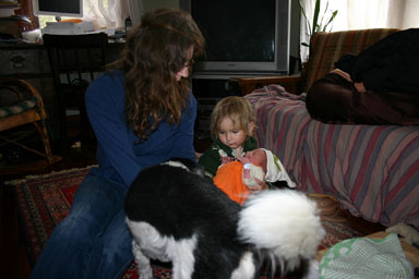
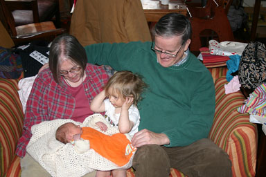
Konrad comes home
Konrad came home yesterday afternoon, and has been entertaining us ever since.
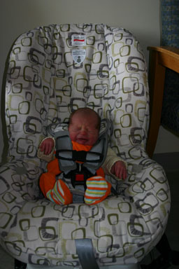
Konrad gets ready to blast off from the hospital.
April 30, 2010
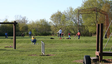
Busy evening at Etna Playground
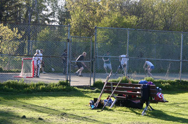
I took Sungiva to the Etna Playground last night, to give her some respite from the responsibility of being a big sister. There were four other kids when we got there at 4:45, and then a brief period where she was the only kid. Around 6:00, though, the parking lot filled and both adults and kids filled the park. It was Dryden Kiwanis T-ball time, and there were adults playing hockey on the tennis court.
